Dempster Highway
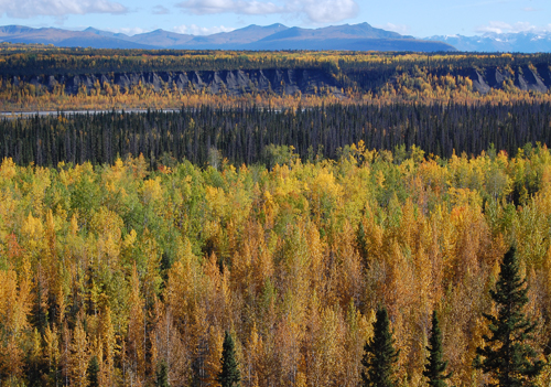 Mark had driven our Subaru Forester to Alaska in March. We decided that it would be fun to take a side trip on the way back home to Port Townsend. The side trip would be up the Canadian Dempster Highway, past the Arctic Circle and to Inuvik, Northwest Territories near the mouth of the Mackenzie River, just off the Beaufort Sea.
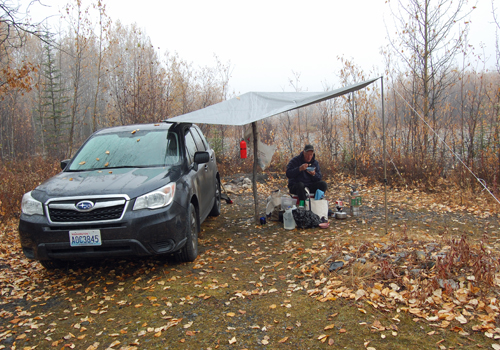 Along the 3,300 mile road-trip we would avail ourselves of the very fine public campgrounds of Alaska, the Yukon and Northwest Territories, and northern British Columbia. The Subaru Forester offers precisely the minimum space for "car camping", and accommodated a special air mattress designed to just fit inside this class of vehicle. In addition, we carried a small awning to fend of the occasional rain, a small gasoline burning camp stove, and our "chuck wagon", a nylon gym-bag that carries a skillet, a sauce pan, cutlery, 2 each plates, bowls and mugs, tea and coffee brewing cone, condiments and, for the occasional motel stay, an electric tea kettle. This minimalist equipment, combined with the contents of our small ice chest, allowed us to make excellent meals throughout the trip. We also took along an axe to split wood for frequent campfires. This has always been part of Mark's equipment for drives north, as on occasion it has proven necessary to remove a tree that has come down across the road. Mark has now made the drive to or from Alaska 29 times, in winter, spring and fall, but is yet to do so in summer! To cap it all off, the Subaru averaged 31.2 MPG over the entire distance of the trip, which considering the nature of the road (about a thousand miles of the total was on gravel and mud), the all-wheel drive configuration, and the load of equipment carried, proved to be a very welcomed surprise.
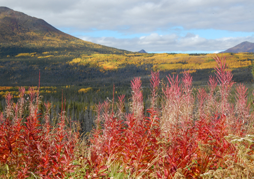 Nancy flew back up to Cordova after finishing her Sierra hike, and on September 11th we took the ferry from Cordova to Valdez. Our route was up the Richardson Highway and the Tok Cutoff to Tok, then north on the Taylor Highway to Chicken, the Top of the World Road across the Canadian Border to the Yukon River and then the ferry across the river to Dawson. Twenty miles east of Dawson, on the North Klondike Hwy, the Dempster Hwy begins. It's 442 miles each way to Inuvik on a graded haul road with two ferry crossings. On our return southbound, back on the North Klondike Hwy, the route went south to Whitehorse where we joined the Alaska Highway and the familiar route home.
A place that we had both wanted to visit was McCarthy and the old Kennicot Copper Mine. The first 20 miles of the 81 mile route is paved and the remaining 61 miles is on a graded road, some parts fairly rough. The road ends at the Kennicot River where one must walk across a bridge, and then either walk or take the shuttle bus to McCarthy and on to Kennicot. Being the end of the tourist season, it became apparent that we would have to stay over two nights in order to have enough time to see the old mine. Unfortunately, the commercial camping area was completely exposed, with no toilets, and with the winds blowing down from the glacier. So we back tracked 5 miles and stayed at a rest stop provided by the Alaska Division of Forestry with a picnic shelter and restrooms.
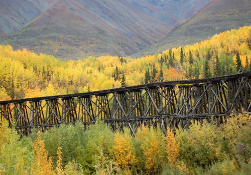 A spectacular feature of this remote road, however, is the Gilahina River Rail trestle. The present day road follows a portion of the original Copper River and Northwestern Railway that was built from its terminus at the port of Cordova to exploit the rich Kennicot copper resources. The original trestle was built in the dead of winter in 1911, requiring only 8 days! Fire was always a threat, as the wooden structure became saturated with oil over time, and the steam powered trains of the day were notorious for emitting sparks. In 1915 the inevitable fire destroyed the trestle. It was completely rebuilt in 10 days, an astonishing feat when considering the fact that timber had not been pre-staged as it had been in 1911.
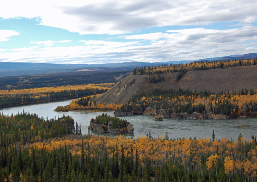 The history of Chicken and Eagle in Alaska, and Dawson and Whitehorse in Canada, center around the major rivers of the area and the gold rush of 1898, which continues today. The Yukon River, the 3rd longest in North America, starts at Llewellyn Glacier at Atlin Lake, British Columbia and travels 1,979 miles through the Canadian Yukon into Alaska until it finally empties into Norton Sound in Western Alaska. It was the major route of transportation to the 1898 Gold Rush in Dawson.
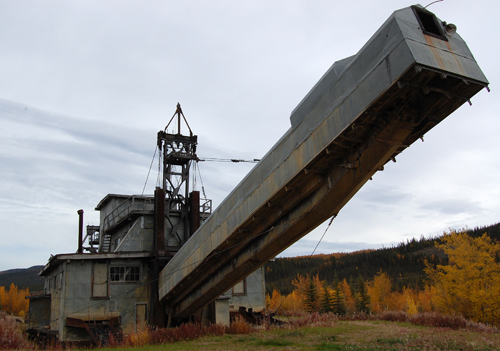 The Peel and Mackenzie Rivers in the Yukon and NW Territories drain into the Beaufort Sea and Arctic Ocean and are experiencing their own modern day gold rush. We would follow parts of these rivers and experience some of the history of the gold rush and local Native American peoples.
The real journey began when we headed north on the Taylor Highway. There are only two settlements on this 160 mile road, Chicken and Eagle on the Yukon River. Both have been the scene of past and present day gold mining. The road passes through endless miles of taiga forest, thin, short black spruce trees. It was elk hunting season and small RV camps were setup along the road, with four-wheeler ATVs used to track down their prey.
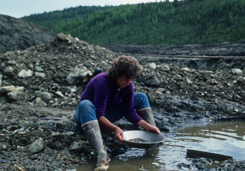
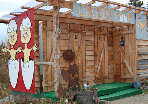 Gold was discovered in the Chicken area in the 1890's and the original community was founded. Today the town has 30 summer residents and draws dozens of Alaskans and internationals that try their hand at gold mining. Several places along the highway nearby are designated "public gold panning areas." We'd stop, fill up on gas, use the local facilities and enjoy a lunch at the Chicken Creek Cafe.
Sixteen miles north of Chicken is the junction with the Top of the World Highway, winding along the top of the mountain range into Canada. The border crossing is the northern most international border crossing in all of North America. The highway ends at the Yukon River with a ferry crossing into Dawson City.
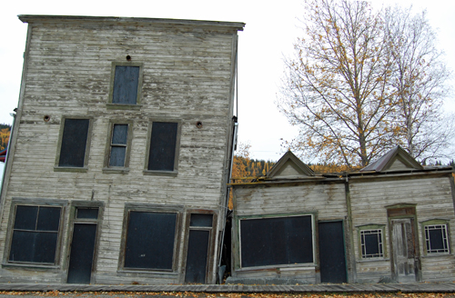 Dawson City became famous when gold was found on Rabbit (later Bonanza) Creek, a tributary of the Klondike River, in August 1896, but not until the middle of July 1897 did the news reach the outside world. The description of "a ton of gold" in Seattle's Post-Intelligencer newspaper triggered a veritable stampede. By then miners on the scene had already staked every creek in the Klondike River and Indian River watersheds. Dawson grew slowly throughout the winter of 1897 but when the Yukon River thawed in May 1898 hundreds of boats arrived. One hundred thousand would-be miners actually set off for the gold fields but only about thirty thousand made it to the Yukon.
 In 1985 Nancy had stopped in Dawson City on her way up to Alaska. Its appearance remains largely unchanged due to its designation as a Canadian National Historic site. During the summer season the town, with its boardwalk-lined streets and historic buildings, is a living museum with costumed interpreters presenting guided tours and programs. Being late in the season, the interpreters were gone, but Diamond Tooth Gerties Casino, combining gambling with live cabaret-style entertainment, was still open. We made the most of our time, and then continued on for the Dempster Highway.
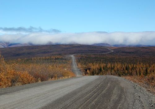 Construction of the Dempster Highway was sparked by Canadian Prime Minister John Diefenbaker's "Roads to Resources" policy which addressed the need to access the natural resources of northern Canada. Between 1958 and 1961 about 115 km of a winter haul road was established from its southern terminus to Eagle Plain. Less than hoped for results in the search for hydrocarbon exploration led to decreased government funding and sporadic construction for the next 10 years. Subsequent oil exploration in the Mackenzie Delta and the Beaufort Sea brought the completion of the road in 1979.
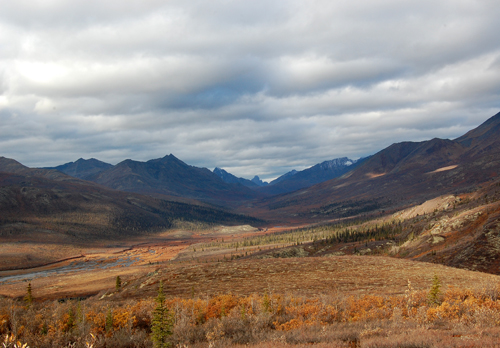 The Dempster Highway, Canada's first all-weather road to cross the Arctic Circle, was officially opened on august 18, 1979. Nancy drove the Dempster Highway to Inuvik in 1985. Not much has changed since 1985 except the establishment of the Tombstone Territorial Park and the growth of the Inuvialuit and Gwich'in people's settlement of Inuvik.
 All of the literature talks about the abundance of wildlife such as Dall's sheep, Arctic foxes, caribou, moose, grizzly and black bears, and wolves. Nancy had her eyes peeled for any sign of moose or caribou, but the only wildlife we spotted was a black wolf that crossed the road. The Hart River and Porcupine caribou herds winter over in the southern range of the Dempster but they were nowhere to be seen even though it was their migrating season.
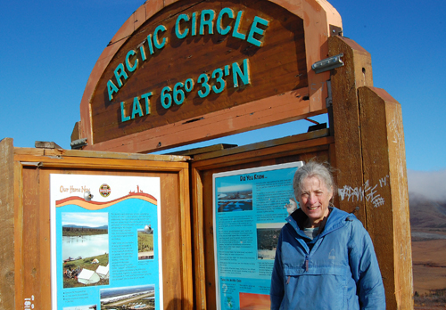
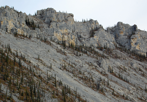 The road follows open river valleys, transits gorges and passes through various mountain ranges, then follows the Eagle Plain Plateau. Two-thirds of the way up the Dempster the road crosses the Arctic Circle, then enters the Northwest Territories and descends into the lowlands of the Peel and Mackenzie rivers, heading downriver to the sea. The river crossings, first at the Peel River followed by that the Mackenzie River, are available year round, including in the winter as ice bridges. The only time crossings are not available is during freeze-up in the fall and break-up in the spring.
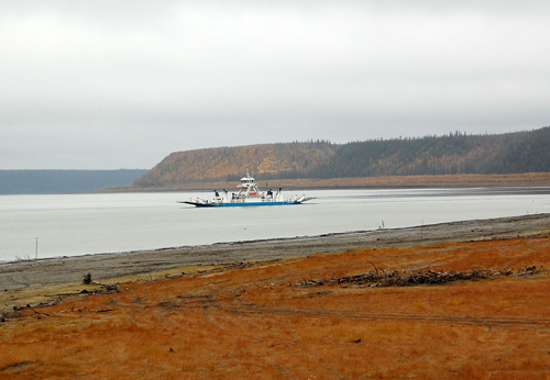
 Heading north, downriver to Inuvik, the road parallels the vast delta of the Mackenzie River, and eco-region that is 50% wetlands. The longest river in Canada, the Mackenzie flows over 4,200 kilometers from its headwaters in northern British Columbia into the Beaufort Sea. Its watershed comprises one-fifth of Canada's total land area.
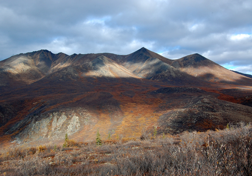
 The Dempter currently ends at the settlement of Inuvik. Its modern location replaced the hamlet of Aklavik in the Mackenzie Delta (which was subject to flooding and offered limited space for expansion). Today it is the administrative and commercial center for the Canadian Western Arctic, and the largest Canadian community north of the Arctic Circle. A 137 km two lane graded continuation highway to the settlement of Tuktoyaktuk on the Beaufort Sea is currently underway. Road access to Tuktoyaktuk is another of the many changes opening up the NW Passage.
The weather was getting cooler and the feel of winter was in the air. We had rainy weather on the northbound drive, obscuring many of the vast views of this fantastic area. Luckily the weather cleared for the southbound drive and we were able to enjoy the views we missed.
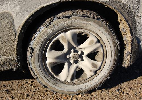
The homeward route of course would reverse that of the northbound. At Whitehorse we were able to pressure wash the heavy accumulation of the clay laden mud that had been firmly packed to the Subaru undercarriage, then regain the familiar route south via northern British Columbia's Stewart to Cassier road that we'd travelled many times before. This would take us through this incredibly scenic region at the most colorful season of the year. (see blog posting 2010-10-31)
Labels: Chicken AK, Dawson Yukon, Dempster Highway, Inuvik, Mackenzie River, Tombstone Territorial Park, Yukon River. Kennicot Copper Mine


0 Comments:
Post a Comment
<< Home