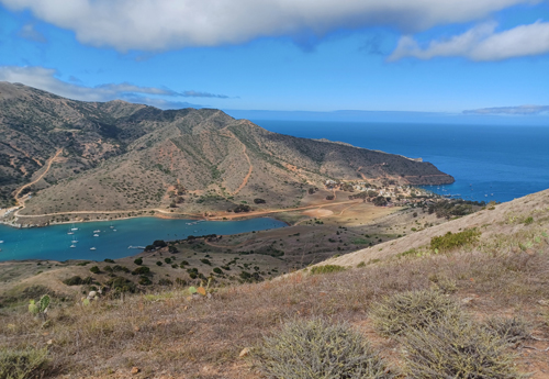
Nancy has long wanted to go the Big
Bend National Park, located in southwest Texas . But the region can
be very hot most of the year. Mark, always ready for another major
road trip, would be leaving for Alaska at the end of February, so we
decided to go immediately and departed on January 2, 2023.
The main objective was to visit Big
Bend, explore more of New Mexico and visit Mark's friend Ted in Los
Cruces, NM. We made a reservation in a concessionaire hotel for two
nights in Big Bend NP, and planned the rest of our time around that
stay.
In the course of our many road trips,
we have driven on ninety percent of the roads in Nevada, so we took
an alternate route and started out moving fast along the Columbia
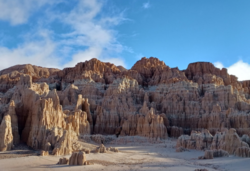
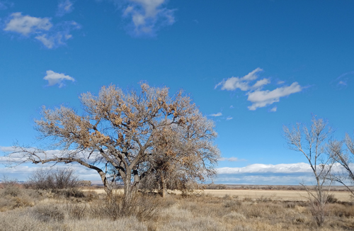
River, into Idaho, then finally south into Nevada from Twin Falls. We spent
the night in Caliente, NV to enable Nancy to get an early morning hike in Cathedral Gorge State Park. But the extensive atmospheric rivers passing over
California and Nevada were bringing rain to an area normally quite
arid. When we got to the parking area the next morning Nancy talked
with a Park Ranger and learned that the trails had turned to
gumbo-like mud bogs. Indeed when she went to check them out, after 10
steps her boots were thoroughly caked in mud. With many alternatives
to choose from, we just moved on to the next.
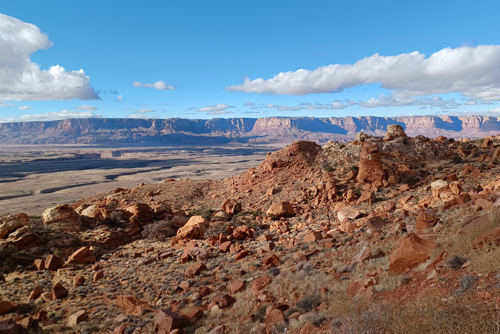
We wanted to avoid the Interstate
highways as much as possible, so we headed east to northern Arizona,
just south of the Utah border, through the Vermilion Hills then along
the Navajo Wind Talker highway into New Mexico.
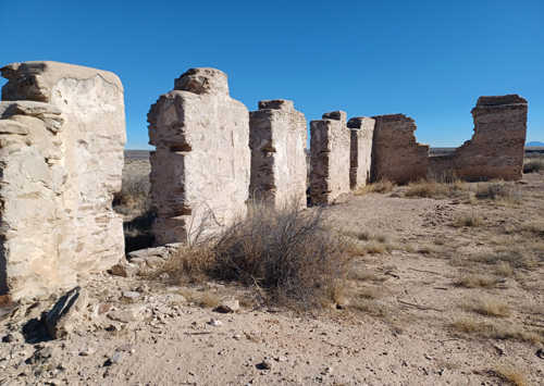
On our way south to Las Cruces , we
stopped to visit Fort Craig National Historic Site. Established in
1854 by the 3rd US. Infantry Regiment, the fort played a
significant role in 19th century New Mexico. Situated on
El Camino Real de Tierra Adentro, the 1,200 mile Spanish Colonial
trail from Mexico City to Santa Fe, it was intended to protect
travelers and settlers along the trail from attacks by Apache bands
led by notable Apache leaders Geronimo, Victorio and Nana. During
the Civil War the fort played an important role in repelling the
efforts of what was called the Confederate Army of New Mexico in the
Battle of Valverde. Though the Confederates held the battle ground,
the Union maintained control of Fort Craig. This stalled the effort
of the Confederates, preventing them from capturing vital supplies
they needed as they marched north towards Albuquerque.
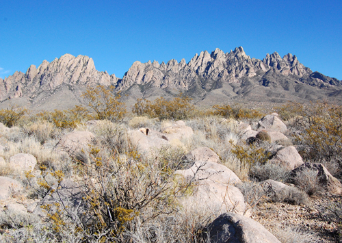
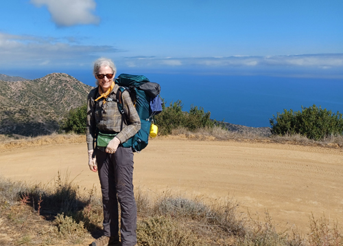
During our two nights visiting Ted,
Nancy got in a hike at Organ Mountains – Desert Peaks National
Monument. At the Dripping Springs trail-head is La Cueva (the cave) formed in the
volcanic tuff, one of several volcanic rocks that make up the Organ
Mountains. She was surprised to learn that the Monument had about
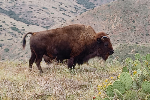
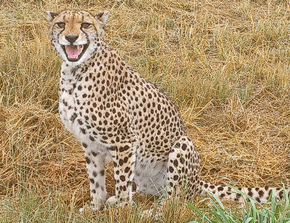
6,000 resident onyx, native to Namibia. Unfortunately they range on
the east side of the mountains and are rarely seen except during an
open hunting season.
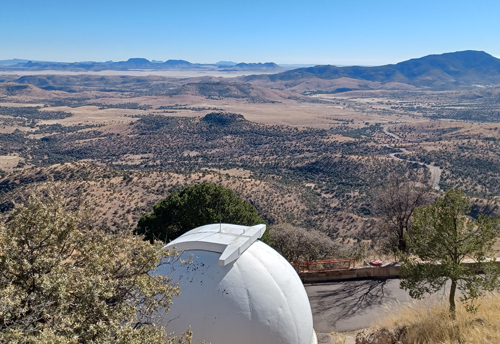
SW Texas is known for its clear, open
skies and two of the the towns enroute to Big Bend, Marfa and Marathon,
attract visitors with their clear and brilliant views of the night
skies. Unfortunately, the moon was just waning and its light
obscured the millions of stars that would have been visible with a
new moon. On our return route we stopped at the McDonald Observatory
built outside Fort Davis, TX because of the region's clear sky.
Built in 1939 the observatory pursued leading-edge research and was
one of the top 3 observatories in the world at the time.
It's
still conducting world-class research by a consortium of The
University of Texas, Austin, Pennsylvania State University,
Lüdwig-Maximilian-Universität
at München,
Germany and Georg-August Universität,
Göttingen,
Germany.
We had debated what camping gear to use
during our stay in Big Bend, but decided that as the park would be
the only place we'd camp, it would be impractical to carry equipment
for such limited use. Instead we decided to stay at the Lodge. In
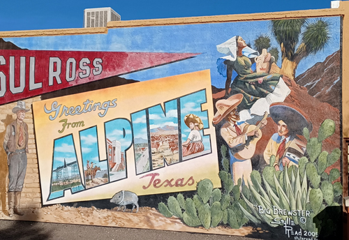
order to maximize our time in the Park we spent the night prior just
outside the Park in Alpine and entered the park early in the morning
thru the Persimmon Gap Entrance.
After checking into the Park at
Panther Junction, we proceeded to the east side of the Park where
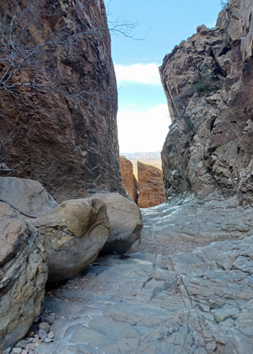
Nancy hiked the short Boquillas Canyon Trail along the Rio Grande.
There were several Mexican citizens from the small village of
Boquillas del Carmen (just across the river) selling their hand
crafted items along parts of the trail. We soon learned that there is
a legal Port of Entry crossing, open only during the day. Villagers
provide boats to cross the river and, if you don't want to walk the
half mile up to the village, you can rent a donkey or car.
Unfortunately, Nancy didn't bring her passport ID card or we
certainly would have taken the journey across. The village of
Boquillas has a modern solar farm that provides all electrical needs
for its 260 inhabitants. There are two restaurants and reportedly
it's possible to spend the night if one wanted to. Its isolation along
the border reminds one of a time when crossing the border was easy
and pleasant.
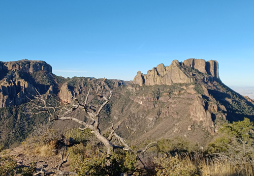
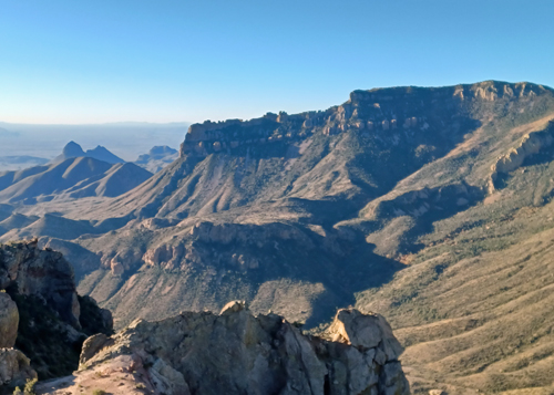
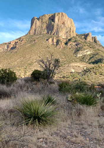
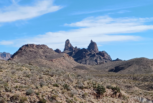
Chisos Basin, where the lodge is
located, rises 2,000 ft above the desert floor, transiting from the
arid desert to cooler mountain habitats. Casa Grande Peak and the mountains surrounding
the basin have been formed by volcanic eruptions. Nancy hiked the
two most popular trails: The Window, thru Oak Creek Canyon to the
Window pour-off, and Lost Mine Trail, with views of Casa Grande and
Juniper Canyon.
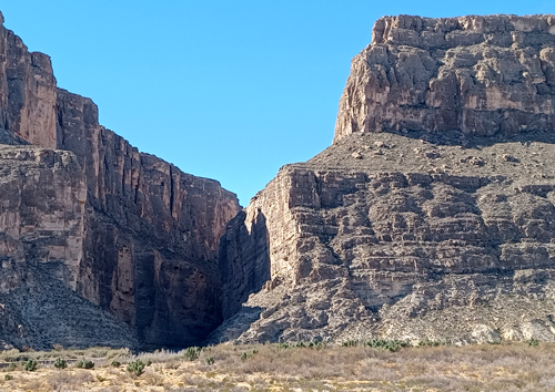
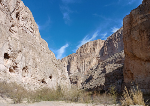
We spent an afternoon driving the Ross
Maxwell Scenic Drive to Santa Elena Canyon where the Rio Grande cuts
thru the limestone of the Sierra del Carmen Mountains. The road also
passes thru Castolon Visitor Center. Castolon was settled in the
early 1900s as people began to live and farm along the banks of the
Rio Grande, downstream from Santa Elena Canyon. From about 1912 to
1920, revolution raged in Mexico and many Mexican families moved
north of the river to avoid the bloodshed and bandit raids.
In response to a later revolution (the
Escobar Rebellion of 1929), the U.S. Army Air Corps established a
landing field at nearby Johnson's Ranch. By the early 1920s, La
Harmonia began farming cotton. Though a not-so-prosperous endeavor,
it nevertheless continued for two decades.
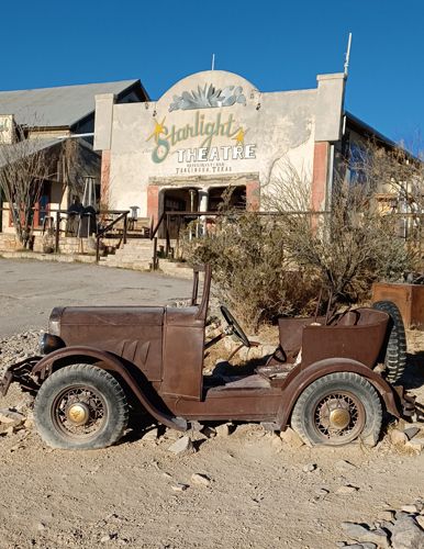
We exited the Park west ward into
Terlingua, then north to Alpine. If we were to do it again we would
definitely spend four or five days in the park, exploring the many
desert trails, and not miss crossing the Rio Grande to visit
Boquillas del Carmen.
Leaving Big Bend, our original plan was
to return to New Mexico through the Guadalupe Mountains National Park
and on to Carlsbad Caverns. Instead we decided we wanted to spend
more time with Ted so returned to Las Cruces via El Paso for a few
more days. When we left Ted's we headed east by White Sands, which we
had visited a few years ago, then over the Sacramento Mountains to
spend a night in the town of Carlsbad.
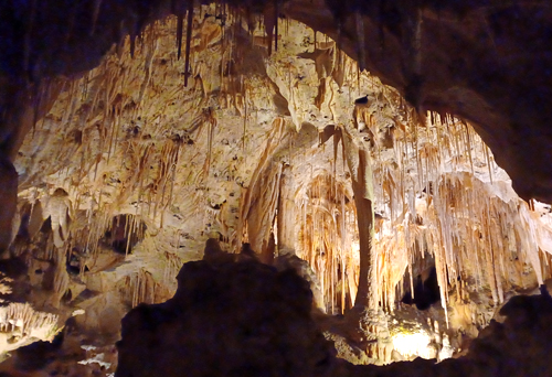
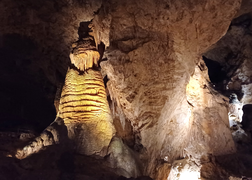
The following morning we
visited Carlsbad Caverns which are quite spectacular, the largest
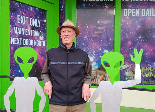
caverns either of us had visited. Because we were so close, we just
had to visit “Area 51”, so after visiting the caverns we headed
north to Roswell, NM for the night. The whole town caters to the
alien theme, including our motel.
We had received a text message from a
friend about Bosque del Apache National Wildlife Refuge where sandhill cranes, snow and Ross's geese, and fifteen species of ducks
winter over. With such an abundance of prey, bald eagles and red-tail
hawks are numerous as well.
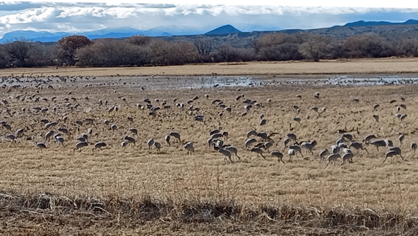
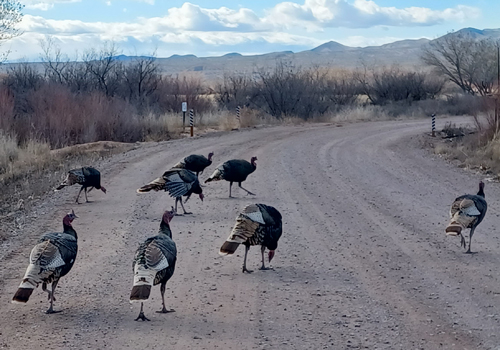
So from Roswell we drove west towards
Sorocco to visit the refuge. Unfortunately the best we could do
photographically, not having a large lens, were the wild turkeys
walking down the road. Normally the sandhill cranes take off at
dawn to fields to glean remaining seeds and grain, then return at
sunset. However the day we were there was very windy, and the huge
flocks of sandhill cranes were staying put, with only a few small flocks
flying within the refuge.
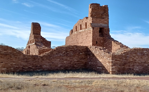
Nancy had noticed the three historic
sites of the Salinas Pueblo Missions on our way south that she wanted
to visit as we drove north. We visited the Albo Mission site, its
pueblo established originally by the early Ancestral Pueblom and
Jumano group. The mission was established in 1625 by the Spanish
Franciscan missionary Fray Francisco Fonte.
We had hoped to head north towards
Farmington, NM, then west into eastern Utah making our way back to
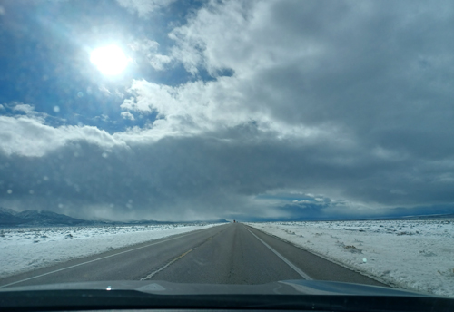
the Pacific Northwest. But a series of storms moving across southern
Utah, northern Arizona and Albuquerque forced a change of plans. To
the north, snow storm warnings had been posted. Without designated
snow tires on the Subaru the threatening weather made us elect the
alternative to avoid the storms and make for southern California via
southern Arizona, the Cochello Valley, then finally north on I-5.
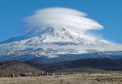
As we passed Mt. Shasta we knew we
were back in the Pacific NW.