
Hitting The Trail
 As one gets older and looks back on life, it's inevitable to ask,” What do I still want to accomplish before it isn’t possible to do so physically or mentally”. I’ve always wanted to do a long hike and have been seriously considering the Pacific Crest Trail, 2,663.5 miles for some time. After thinking about it for several years, I finally picked a start date and began making plans.
I knew that this was something that I would be starting on my own and that I would do it in sections over several years rather than completing it as a “thru-hiker”, one who does it all in one season. It made sense for me to start at the Mexican Border for several reasons: 1) I had good support in Southern California, 2) I could re-supply as often as every 5 -6 days, minimizing the amount of weight I’d have to carry, and 3) if I couldn’t continue for any reasons there were numerous places to leave the trail. And I could start early April and still get up to Alaska by the end of May for our summer season on Tamara.
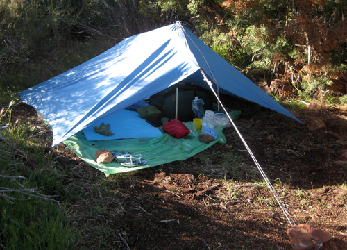
So I began planning and physically training in the Fall of 2011. I made the decision not to buy new equipment until after completing the first section for two reasons - I would know if I wanted to continue the hike and I would learn a lot and observe from the people I met along the way. Both my pack and sleeping bag were 30+ years old - a lot has changed, especially in lightweight hiking gear. The ideal on a long hike is to keep your base weight (gear minus food and water) to 15 pounds or less. One way to compensate for the weight of my sleeping bag was to not carry a stove or a tent. For cover at night, when needed, I would take the fly sheet on my tent (also 30+ years old!) and use my hiking poles as tent poles.
The one question I was asked most was “Are you taking a cell phone?” Call me old fashioned but taking a cell phone/GPS just didn’t fit with my style. Besides, I knew that there would be lots of hikers starting in early April and if I needed a cell phone, one would come along eventually. I had good maps and knew how to read them, a compass, and a very loud whistle if I fell off the trail.
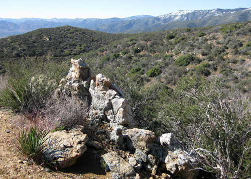
The plan was to start at the Mexican Border and hike the first 210 miles, putting me at Interstate 10 at the base of Mt. San Jacinto, approximately 20 miles north of Palm Springs. As my departure date began to draw near, the big question began to be the condition of the trail around Mt. San Jacinto, as a series of late storms were dropping snow. I felt that by late April the way would be clear. And the late storms were ensuring adequate water supplies on the trail, a major concern on this section of the trail.
Physically I was feeling good. Initially I was concerned that my knees were going to give me problems but they actually seemed to get better the more I trained. A week before departure, the top of my right foot was quite painful and I felt like an athlete who's been training for the Olympics and has a injury just before the Games. Rest for a week and maybe all will be OK.
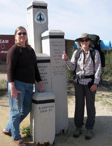
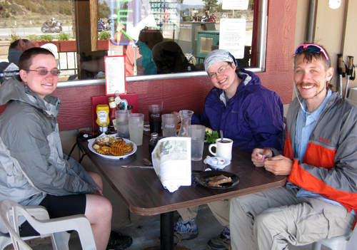
On April 2nd I flew to Orange Co., spent a few days visiting with my mom in Laguna Beach, and on April 5th took the train to San Diego. My cousin Paul and his wife Adrienne, who live on Coronado Is., picked me up and took me to a wonderful Italian restaurant for my last real meal before hitting the trail. Paul, a cardiologist, looked at my foot, asked questions, and said he felt I was "good to go". Early the next morning Adrienne (my Trail Angel!) drove me to the trail head at Campo. I think Adrienne was more excited than I was. Thank you Adrienne for all your support! At 9:15 am I began the hike. “Was I really doing this?!”, I asked myself again and again. But I was on the trail. I was beginning. And I knew that a journey of any kind begins with a single step.
I’m not going to give you a blow-by-blow description of my hike, just some random thoughts. Not once did I feel I was out of my element, despite, at times, hard conditions. It was empowering to know I was on my own, making my own decisions, and doing as well as the next hiker. I've traveled to many places and hikes a lot on my own, but hiking alone for a long distance was a new challenge.
A typical day was up at sunrise, breakfast, break camp and try to be on the trail by 7:00 am in order to get in a few hours of hiking before it got too hot. Before departing Port Townsend there had been only a few days of over 50º and the average daily temperature on the trail was 90º +, though thankfully very dry. Ideally, the plan was to hike until about 11:00 am, break until about 3:00 pm, then hike a few more hours in hopefully cooler weather before making camp. Set up camp, make dinner (remember no cooking), then get organized for a quick departure in the morning. I did take, and had sent in my mail drops, a Smithsonian magazine to read at night for entertainment. A better thermal pad is a must – it seems I tossed and turned all night.
Our friend Larry told me I’d get blisters - I said no, I’m walking 6-8 miles a day, no blisters - I had blisters by day 2. I spent the first week in pain. Of the group of people I met along the way I was the oldest female and hiking alone. I met several men over sixty, but no women. At one point I hiked 4 days with three other people - a guy 27, and two females, 30 and 23. They told me several times how I was an inspiration to them - putting in the same miles and not complaining. Most days I hiked 12 - 14 miles, and I’d say my pack was 30+ lbs. And don’t forget those blisters.
As to my careful planning, I totally blew it on food. Apparently, it’s common for many hikers to loose their appetite and not to eat much the first week or two. I was barely eating half my ration of 3500 calories per day, and I was sending most of my food back when I picked up my supply drops. All the food I thought I’d scarf up was unappealing. Luckily, I was able to get junk-food every 4-5 days at small stores. And at mile 152 there's a great restaurant a mile off the trail that's very popular with hikers. A quick note on no stove. Yes, it would have been nice to have a hot drink at night or first thing in the morning but … I did discover that some of the freeze-dried meals, like Red Beans and Rice, were good cold. I inherited a few from another hiker and found that if you added the required water at noon, it was good to eat by dinner. I think I’ll do a lot better next time.
Of the 15 nights I was on the trail, I spent 5 nights totally alone. The rest of the time I was camping with or close to someone else. Two storms came through while I was on the trail. The first one I was on my own and, knowing a storm was coming, found a good sheltered spot out of the wind, though I didn’t secure my tent stakes as well as I should have. By midnight I had stakes pulling out, the fly sheet flapping and things starting to get wet. At 4:00 am I starting organizing a quick departure for as soon as it was daylight - I was huddled in the middle of my shelter trying not to get any wetter. At daylight it started raining harder, so I decided to wait for it to break then leave. At 7:00 am I was packing up my wet sleeping bag and fly sheet (luckily my pack stayed dry) when it started to snow! I knew I just had to get hiking and I’d be fine. It only snowed a few minutes but it was a wet and very windy day. Several times I thought I’d get completely blown over. I just kept hiking. My only concern was that I wouldn’t get a chance to dry things before it was time to make camp. By afternoon the weather was intermittent rain and sun-breaks. Luckily I had descended enough that when I made camp the sun was out and I could dry out. I really did a good job securing my shelter that night and stayed warm and dry despite it being windy with rain showers all night.
The next storm came in 2 days later, but knowing it was coming, I elected to share a room with two other hikers at an RV Park 4 miles off the trail.
Cell Phones with GPS – it seemed to be more the norm than not. I seemed to have the same perception as GPS tracking in vehicles – it's sometimes better just to look at a map! I didn't get lost once, yet those with electronic devices did get lost now and then. Because I was using just a map, I had to pay more attention to the trail and my surroundings. I may not have been able to tell you exactly where I was, but I wasn't far off.
Remember those late storms? Day three into the San Jacinto Mountains had started out the usual very hot and dry with spectacular view of the desert floor below. As I rounded a north facing ridge I hit snow. Luckily I ran into a young couple I had encountered a few times previously on the trail. They had Yak-Trak type crampons, but I had nothing – remember, there wasn't going to be any snow when I got there. Wrong. The trail was completely covered and we were following the tracks of others. At one point, one of my companions was trying to find the trail with his cell phone. I sat down, looked at the map and realized that all we had to do was follow the base of the ridge until we came to a stream, then head downstream to the area where we'd find a place to camp.
I was glad that I had run into them cause I was having a hard time making way – the snow was getting soft, slippery, and we were all getting tired post holing up to our hips. At one point I had slid downhill on my back and was stuck, like a turtle on it's back. Believe me, I didn't hesitate to play the old lady and ask for help whenever I needed an extra hand. That day ended with us meeting two guys from San Diego out for an adventure weekend. They had invited us to join them at their camp for the night and when I saw snowshoes tied to their packs, asked nicely if I could use a pair. Later at camp, when everyone else was snug in their tents, they weren't sure what to make of the old lady “cowboy camping”, beneath the stars (not using my “tent”), but it was a nice night and I hadn't used my cover for over a week.
The hardest day of the hike was in the San Jacinto Mountains – 12 miles to hike, a very hot day, a 2,000 ft. climb, then a 1,000 ft descent, and finished off with a 1,000 ft. climb. Even the youngsters I encountered were dragging their butts. The next day was the day in the snow. I was only 30 miles from my destination, yet it wasn't meant to be. The trail at miles 185 – 191 was impassable, and the reroute through Idyllwild didn't appeal to me. I wasn't looking forward to my last day - 20 miles, 6,000 ft descent, in 100+ weather. When I heard that the trail to the Tram was clear I headed that way. My original plan was to end up in Palm Springs and the Tram was the most direct option. I was feeling guilty for not finishing, but I had actually hiked further than some – many had taken a trail 10 miles earlier into Idyllwild knowing the trail was blocked by snow. And as a Section Hiker, I could do any portion how and when I liked. I would simply cover that ground later.
A nice couple gave me a ride into Palm Springs and The Chase Hotel, owned by Craig, an old fishing buddy of Mark's. It was strange not having to think about where I would camp for the night and to have plenty of water. Craig had me over for a nice dinner that night – Thank you Craig for your generosity. Two days later I was back into Seattle and thinking about what section I'd hike next. Several people I met have trail journals on the internet and I've been keeping track of their process. It's strange to be sitting here and not on the trail making miles.
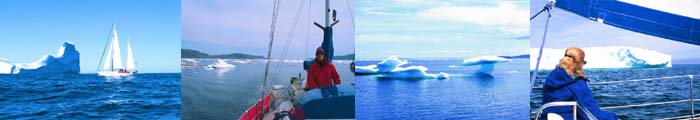
While I was hiking in California, Mark was aboard Tamara cruising Prince William Sound in the winter. Not just any winter, but the heaviest winter in memory---Snowmageddon, Snowpocalypse, Blizzaster it was being called. He made a circuit of the Sound, skiing at a number of places, seeing only one other vessel the entire time. He's written a lengthy story about the trip for one of the sailing journals, but I'll have to pester him to do a condensed version for these pages. And he's still “computer-challenged” enough that he'll need my help up-linking the photographs. I'll let him tell you how he dumped his new camera overboard!!
Labels: PCT
posted by Editor at 11:01 AM
![]()
![]()


3 Comments:
You never sit still for long, Nancy. Congrats on your accomplishment so far. I look forward to reading about future legs of your hike.
Nancy,
Wow.
I had no idea you were going to hike the Pacific Crest Trail! Actually, I had no idea that such a thing existed!
I really enjoyed reading this. Although this time period of my life is busy busy busy with the requirements of being a full-time father and worker, I try and find the time to read about your adventures, and I hope that one day I can follow in your footsteps (preferably with my girls in-tow!). Even though I'm busy, it was nice to find the time to read about your adventure. You're such an inspiration! Way to go!
Thanks for taking the time to write it up.
Here are some things I loved about this write-up:
+ Your insistance on not using technology! Haha. You know there were days before maps, too! It's all relative. But I do see the advantage of not relying on technology... you are more aware of your surroundings and you rely on your instincts more. But I always think it's funny how different generations have trouble "getting on board" with new technology and claiming their ways were better. Don't get me wrong, I'll do the same thing one day! haha.
+ I loved how you were almost never alone. How you communed with other travelers and probably made some interesting friends along the way. (even in Southern California! haha)
+ It's not that I can't believe that you could do this sort of thing, but it's so inspiring that you had a dream and saw it through. So many people don't even have dreams to start with, let alone see it through. It's inspiring, and it makes me proud to be related to you and know that that blood runs through me. I hope I get to experience half the adventures you have.
Anyway, I guess I'm gushing now.
Can't wait to hear more about future adventures!
I'm really impressed with you, Nancy. I have often thought about doing a trail myself. Just read about Granny D who hiked across the country at age 90 so there is lots of inspiration out there. Barbara
Post a Comment
<< Home