Wednesday, October 07, 2015

Alaska Summer 2015

alt text
Alaska, like the rest of the West, has been experiencing a drought in recent years.  One does not normally put Alaska and drought in the same sentence.  With this in mind, the cruise this summer focused on the effects of current changes in weather patterns.

One of the obvious signs this season was the decrease in snow pack.  Normally by mid-May the snow level is fairly close to the shoreline and in some cases still very heavy.  Last year, and even more so this year, the snow level mid-May was more like what one would expect in August.  The town of Valdez, not far from Cordova, recorded six feet less snowfall than the previous record low.  The city of Anchorage, Alaska's largest, experienced the least snowfall since records have been kept. By the time Mark arrived in Cordova in March to begin his late winter solo cruise, the snow line was 800 to 1,000 feet above sea level.
alt text
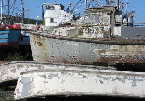
Most towns in Alaska, like many in Washington State, depend on steady melt of snow pack and lakes for their water supply, not enormous dams.  Last year the seafood processing plant in King Cove on the Alaska Peninsula, the largest such facility in the world as measured by product output, was forced to curtail production due to insufficient water.  The town of Cordova relies on snow melt to drive the hydro-electric power plant, and this year’s insufficient water flow would force consumption of expensive diesel fuel throughout the summer fish processing season, the largest such production in history.
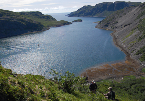
alt text
Alaska forest fires have been occurring earlier and over a longer season the last couple of years.  Fires in the interior of Alaska are especially destructive in that they burn the protective tundra layer over the permafrost, causing melting and the release of methane gases into the atmosphere. By early August, more acres had been consumed by fire than any previous season but one.  It was expected that the previous record would be broken by the end of summer.
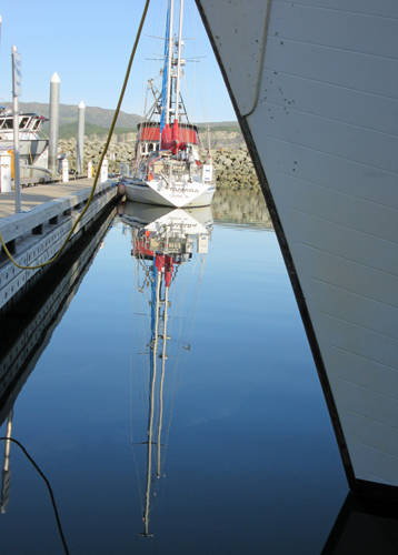
alt text
Sea water temperature is critical to salmon spawning and a rise of only a few degrees can bring havoc  to the  fisheries.  Another effect of warmer temperatures can be an unusually high rate of growth of toxic phytoplankton. The death of an unusual number of sea birds in the Aleutians, as well as ten fin whales found dead off Kodiak Island, was provisionally attributed to this phenomenon.
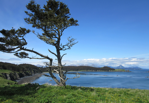
alt text
We were fortunate, however, to note an extraordinary abundance of Humpbacks this season, particularly near the Kodiak and Shumagin Islands.  On several occasions one or more whales breached completely clear of the water very close to TAMARA.  Unfortunately, none ever gave adequate warning for Nancy to be able to aim and focus her camera.  She's still hoping for that great whale shot!
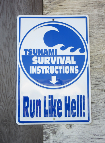
alt text
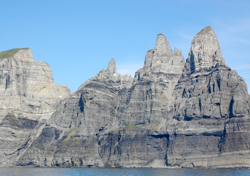
Having made the cruise to the west several times before, we would be breaking little new ground.  Instead we planned to revisit several of our favorite anchorages in the southwest part of Prince William Sound, the Kenai Peninsula, the Kodiak archipelago, the rugged Alaskan Peninsula, the Shumagin and Konuij Islands.  However, this season we ventured a bit off the track on this route to visit the small but important fishing of Chignik on the Alaskan Peninsula.
alt text
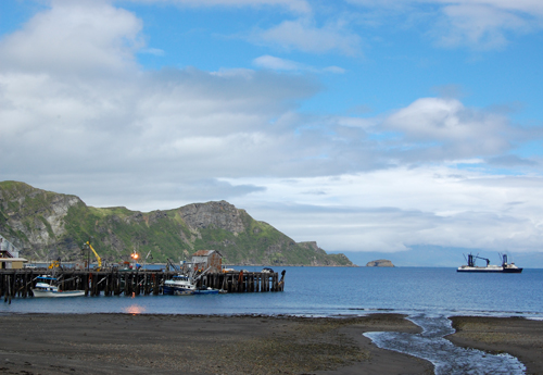
Chignik, the Aleutik word for “Big Wind” is sited at the approaches to a large, but very shallow, lagoon that produces a important Red Salmon run.  The village’s name was exceptionally well chosen, and during much of our time in the brand new, well constructed harbor the place lived up to its windy reputation.

The salmon seine fishing boats that work the Chignik red salmon fishery are generally of very shallow draft, permitting them to work in the lagoon when necessary.
alt text
On our return to Cordova, TAMARA’s home-port, we were pleased to see secured to the transient dock a boat and crew we’d come to know in Patagonia and Antarctica.  SAUVAGE, with Sophie and Didier aboard, was soon to depart for Mexico.  But we were able to spend a few days together, and extensive discussions involving their decision whether to rebuild or replace their main engine hopefully allowed Sophie and Didier to come to a good resolution!  Their latest phone call, from Ketchikan, had them planning to make their best time to Bellingham, WA to take possession of a new engine, which given the extraordinary distances they cover each season will see extensive use.
alt text
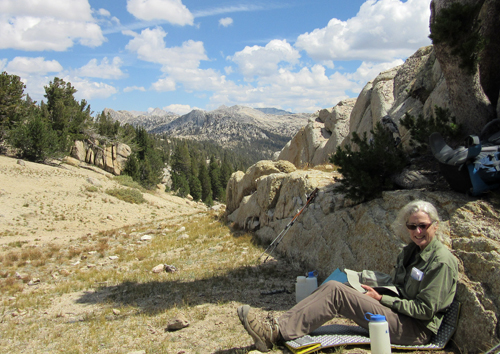
Nancy departed in mid-August to continue her hike of the Pacific Crest Trail.  She would hike from Tuolumne Meadows to Donner Pass, making her total completed miles more than half way.   The main concern on this hike was the fire danger but the only sign of fire was a day or two of very light smoke which she felt was very fortunate.  Mark made yet another drive home, having now completed the spectacular 2,250 mile drive from Alaska through the Yukon and British Columbia more than two dozen times.  For him, it's the best way to make the transition back to the bustle of life in the Puget Sound region.
alt text

Labels: , , , , ,

Monday, July 01, 2013

Alaska Peninsula

Alternate Text

Winter was late to leave Prince William Sound as we headed out of Cordova on May 19th. Thompson Pass above Valdez had just gotten several feet of new snow, and snow was still blanketed the shorelines above the tide line. With each day the snow was slowly retreating, and the melt water was gushing out of streams and the numerous waterfalls that cascade over the mountain ledges.

Alternate Text

Mountain goats had eluded us in the past, but this season we were lucky to actually get a glimpse of goats as they literally graze on shear cliffs in Sheep Bay (no they’re goats!) , our first anchorage . We saw goats again as we transited MacArthur Pass along the Kenai Peninsula. One reason the goats are so hard to see is that they appear as tiny white dots from a mile away. Only with a good pair of binoculars do they emerge as mountain goats, though they still seem small.

Our cruising plan was to move quickly to the Alaska Peninsula so as to be able to spend as much time out west as possible. Nancy would be leaving Cordova the last week of August for Seattle and onto Oregon to complete another section of the Pacific Crest Trail. She is hoping that the many hours on the boat and some physical therapy would be the downtime needed for her knees to recover from the last hike.

Alternate Text

The first obstacle in getting to the Peninsula is crossing the Gulf of Alaska. There are three weather zones that need to be crossed and as we listened to the weather forecast, two areas would be good for crossing but one not good. One way to lessen our exposure time is to continue along the Kenai Peninsula after Prince William Sound, making the crossing time 18 hours instead of 32 hours.

Alternate Text

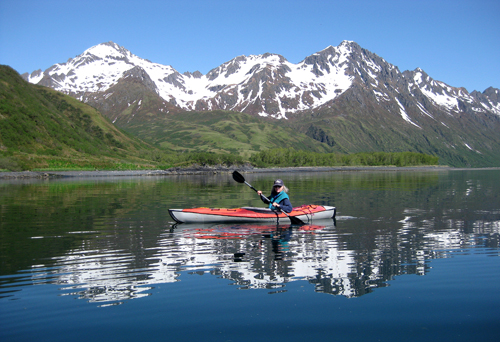
In the waiting there are always pleasant surprises. We had actually left Nuka Bay to cross the Gulf but 20 miles out we had strong head winds and the seas were choppy with waves coming over the bow. The winds were not behaving according to the forecast and we had a hundred miles to go before we could seek shelter. So we turned around and went back to our last anchorage. The result was 2 days waiting in a lovely anchorage where Nancy could try out her inflatable kayak, bought used from a friend in Cordova. When the next favorable forecast came we had an easy crossing all the way to Kodiak.

Alternate Text

Alternate Text

Kodiak City is a good place to re-supply on fresh produce and wine, though visits are kept as short as possible to minimize the coast of harbor fees. Our first day we met Laura and Tom, residents who have a nice motor-sailor, perfect for cruising the Kodiak Islands and Alaskan waters. They offered us the use of a vehicle so we could do shopping the next day, the better stores being a few miles from the harbor. It was especially handy since it rained all the next day and walking, carrying heavy bags would not have been fun. And we had a pleasant dinner at their house afterwards. Thank you Laura and Tom for your generosity!

Alternate Text

Normally we would head north west through Whale Pass for Shelikoff Straits and continue southeast along the Peninsula. This season we’d proceed along the Pacific side of Kodiak Island, through Sitkalidak Passage, explore the bays west of Old Harbor, continue through Geese Channel past the Trinity Islands and cross over to the Peninsula side.

Alternate Text

Alternate Text

It was decided to wait out the strong westerlies behind a spit in the entrance to Three Saints Bay. We had already waited out a gale in Shearwater Bay, an anchorage we had used in July 2011 (see blog entry July 18, 2010) and were hoping to find an anchorage calm enough to play around on shore. As it turned out, the weather was sunny and clear and the anchorage well protected from the wind, allowing great beachcombing.

Alternate Text

Alternate Text

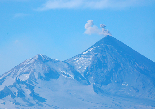
Everyday, on the radio weather forecast, it was announced that Pavlof Volcano was active. After leaving Sandpoint we planed on anchoring on the north shore of Dolgoi Island at Bluff Point right under Pavlof, in hopes of seeing the volcano. It had been cloudy and rainy when we anchored and into the next day. But on the second day, as the evening progressed, there were period of clearing on the mountains. First just the ash dusted slopes were visible, but eventually the peaks of Pavlof and Pavlof’s Sister Volcanoes poked through the clouds and the continual belching of smoke from Pavloff was clearly visible.

Alternate Text

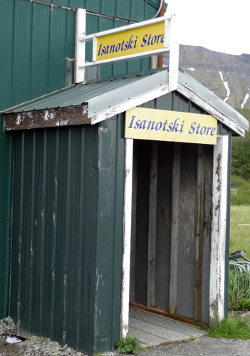
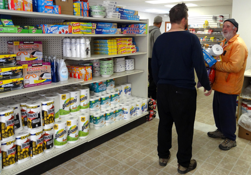
We were headed for Dora Harbor on the south coast of Unimak Island with a forecast for a SE gale, but decided as we approached False Pass to instead to proceed thru False Pass and anchored in an embayment that we knew to be well sheltered. Each new forecast increased the winds until we had continuous 30-40 knot winds in the anchorage itself, with gusts at 40+ k. It’s at these times when our 88 pound Delta anchor and all chain rode is well worth every bit of the weight. After two nights sailing on the anchor, our nerves frayed, we headed into the new small boat harbor at False Pass to sit out the strong NW winds forecast for the next day, as there is no other anchorage to provide shelter from strong north westerlies. But we always enjoy our time spent in the small fishing villages of Alaska, and it would give us opportunity to visit the community and buy a few fresh items from the small, but surprisingly well stocked village store.

Alternate Text

Alternate Text

Nancy was determined to go to Dora Harbor , but with a forecast for 20-25 k NW winds Mark was not convinced it would be a good anchorage. And he was right!, of course. The first obstacle was trying to avoid the gillnet boats fishing off Cape Pankof The forecast wind was 20+ knots out of the NW, but the effects of the mountainous terrain accelerated and amplified the wind, working up rough seas that made finding the ends of the nets very difficult. Then the forecast was upped to 25-30 k NW winds with gust 35+, again amplified and focused by the imposing mountains, and the two nights in Dora were spent once again hanging by our toenails, unable to get ashore, as it was far too windy to safely launch and use the dinghy. To add to the stress, gillnet boats came in each night to anchor, and always seemed to want to anchor as close as possible to Tamara.

Alternate Text

We left Cordova hoping to make some progress out the Aleutian Chain, but the weather to that point hadn’t been cooperating. Technically we were in the Aleutians, just barely. But one has to keep reminding oneself that it’s not the destination but the journey. In another week it would be time to start the trip back to Prince William Sound and the forecast east of Dutch Harbor was for another gale. So we reluctantly decided that Dora Harbor would be as far west as we’d proceed. With the next favorable forecast we began the voyage back to the east. We intend to spend some time exploring little used harbors in the outer islands of the Shumagin group. To that end we’ve been gathering whatever “local knowledge” available, as this region is still poorly charted and seldom visited.

Alternate Text

Alternate Text

Labels: , , , ,

Tuesday, June 21, 2011

Alaska Peninsula

Alternate Text
It was a relatively easy passage from Cordova to Kodiak; one week all together, overcast skies, a few lay days due to winds, but the Gulf of Alaska treated us fairly after a few days in Prince William Sound and on the Kenai Peninsula. The Kodiak Crab Festival was in full swing when we arrived, the sun was out, and everyone was having a good time enjoying the carnival rides, survival suit races, and copious food from the vendors. And the seine fleet was making ready for their first opening, repairing nets, provisioning, etc.

Alternate Text
The day we left Kodiak, Mark twisted and badly strained his foot, making getting around for him almost impossible. Since the weather forecast for Shelikof Straits was strong SW winds (on our nose), it was decided to go to Long Island (see July 2010) where we knew the anchorage was good in all winds and Nancy could hike around on her own. As noticed on our visit last year, and again this year, there were signs everywhere of cows yet no cows were sited as we hiked. We began to assume that they were phantom cows and came out only at night. But the night before we left, Mark actually spotted cows grazing with a few deer on a small grassy ridge - finally a siting of the phantom cows!

Alternate Text

Alternate Text
As Mark's foot healed we slowly made our way west, arriving Sand Point a week later. Established by a San Francisco fishing company as a cod station and trading post in 1898, Sand Point is today a thriving town with over 50% of it's permanent residents Aleuts or Unangan. We learned this year that a small buffalo herd is kept on the island.

One of our goals while in the Sand Point area was to pay a visit to Nagai Island and collect rock samples for a UW Geology alumni friend of Nancy's who is planning on doing some work in the area next summer. A weather window opened up and we made a quick trip and successfully collected samples which Nancy then sent via US Post (if it fits it ships!-even rocks) to New York state. We've been asked to also collect samples from Sanak Island which is a little more difficult since it's really out on the edge of things, and the anchorages are only good in fair weather. We'll attempt a stopover at Sanak on our return trip from the Bering Sea.

Alternate Text
Cannery workers in many of Alaska's seafood plants, in the recent past, were mostly Philippinos and Mexicans with a few US college students thrown in. In the earlier days, Chinese, Japanese, Irish and Italian. Things continue to change, as has the world. Last year, while we were in Kodiak, there was a local controversy concerning a group of Turkish students that were contracted to come and work. When they arrived, they found that there was no housing available to them and people in town were trying to find places for them to stay. All in all it was not a good deal for the students.

While in Sand Point, Nancy had a long conversation with a Chicano cannery worker who said that most of the workers at the Trident Cannery in Sand Point now are students from places like Uzbekistan, Turkmenistan, and other ex-Soviet states. Nancy met three students from Mongolia while at the internet cafe. They reported that they pay an agent $3,000 to $4,000 dollars to come over and work. The agent arranges their visa, transportation and employment. The average wage is $8 per hour so the workers must work over 400 hours just to break even and all within a three month period. However most work sixteen hour days, so the over-time mounts quickly. They also strive to improve their English during their time in the U.S. Their motivation is extraordinary.

We're currently in King Cove, the last good harbor before False Pass, through which we will pass north from the North Pacific into the Bering Sea. Captain Cook, on his exploration of the region, thought that the pass did not truly connect the two oceans, hence the name that he bestowed. But he was wrong, and for many years the fleet has used False Pass on it's way to and from the Bering Sea crab grounds, or the Bristol Bay salmon fishery.

Alternate Text
King Cove got it's name from a trapper and fur trader named King who ran a trading post late in the 19th century and prior to the opening of a cannery in the early 1900's. King Cove exists primarily because of the Peter Pan Seafoods cannery that operates year round, processing millions of pounds of salmon, cod, and Bering Sea crab each season. King Cove is younger, while Sand Point is and has long been a native village and trading and fishing outport, but also has two canneries which, like King Cove, are the basis of its economy today.

Alternate Text

Alternate Text
This will be our last opportunity for internet and provisioning for awhile. The new harbor in King Cove is practically empty, so we had our pick on spots to tie up. Our friend Chuck Molisky, from Port Townsend, who is skippering a tender for Peter Pan Seafoods, stopped by to visit on his way to Bristol Bay. We hope to find him again later in the season somewhere in the Kodiak area, after he moves to that fishery after the important Bristol Bay Sockeye salmon run.

Alternate Text

Labels: , , , , ,

Friday, September 24, 2010

Prince William Sound

Alternate Text

During the first part first of our Kodiak visit we concentrated our efforts cruising the southeastern coast of the island group. By the middle of July we headed for the northern island group. Our first stop was the native village of Ouzinkie ( population 192) on Spruce Island, home to St. Herman, the first canonized Russian Orthodox saint in North America.

Alternate Text

From Spruce Island, we crossed Marmot Bay to Afognak Island, the second largest island in the Kodiak Archipelago, and anchored in Afognak Bay. A couple we had met on Kodiak told us that there was a good hike along the Afognak River up to Afognak Lake and indicated that there would be lots of Kodiak Bears. We never did see any bears but we saw LOTS of scat on the old logging road that parallels the river. The Afognak Native Cooperation privately owns the island and logs a large section of the island, the effects of which became more noticeable as we entered Izhut Bay. The bay offers great whale watching and has several good anchorages, but most of the area has been logged down to the shore, making hiking impossible, as the thick underbrush that first grows back is impenetrable.

Alternate Text

While anchored in Sopasa Bay, we twice sucked the omnipresent jellyfish into our cooling water intake system, shutting down our small diesel generator. In our ten years on the boat we have only had this happen once before. The one sure way to clear the system - use an air horn to blast out the blockage! But all the bays were full of jellyfish and we were running out of the small air canisters for the horn. Luckily, we did not have another such encounter --until Prince William Sound!

Alternate Text

Seal Bay, on the north coast of Afognak, was very picturesque with only one of it’s many small bays having been logged. There was good hiking along the shores and in the woods and well protected anchorages. Our plan had been to continue onto Shuyak Island, the northern most island, but it had been raining almost daily the last couple weeks and Prince William Sound was beckoning. With a good weather forecast we crossed the north Gulf of Alaska on August 2nd and re-entered Prince William Sound.

Alternate Text

We spent the next two weeks in Western Prince William Sound, stopping in some previously visited anchorages and exploring some new ones. From mid-July to mid-August we had only two days of little or no rain. As soon as we’d see a break in the rain we’d jump in the dinghy and get to shore to walk. And with all the moisture you’d think the mosquitoes would be thick as thieves, but we encountered very few. Perhaps they couldn’t fly with their wings so wet!

Alternate Text

Alternate Text

Towards mid-August the weather started showing signs of improvement and sunny days began to out number rainy days. Fortunately some time remained to continue the cruise before returning to Cordova on September 1st. After all our miles in TAMARA, not a very ambitious season, about 1300 miles in all, but in a still relatively unraveled part of the world. And of course the history, scenery, and adventure of the region make for a wonderful season away from the ordinary.

Alternate Text
Nellie Juan Anchorage, June

Alternate Text

Nellie Juan Anchorage, August

Our return to Cordova was festive again this season. Though not returning after so long and so far as we did a year ago, this season saw one of the finest salmon seasons on record for both the Cordova seine and gillnet fisheries. Coupled with the finally arriving spectacular late summer, the mood all about town was up-beat.

Alternate Text

Alternate Text

The weather this summer had been some of the worst on record. Anchorage reported thirty-two consecutive days of rain, which is very unusual, as that area is generally comparatively dry. Yet the winds were light with no big storms. But summer did finally arrive by mid-August and Prince William Sound enjoyed a month of almost perfect weather and little wind. Everyone was out hiking, berry picking, boating, just enjoying the sunshine after such a bleak summer. And for those crossing the Gulf of Alaska, a notoriously tempestuous area by September, it was smooth sailing. Everyday you’d hear someone say, “How much longer can this last?”, or “This is very unusual for this time of year.” But all good things must come to an end and today, the 24th of September, there’s a storm warning in the Gulf Alaska and a gale in Prince William Sound.

Alternate Text

Alternate Text

Labels: , , , ,

Monday, July 19, 2010

Summer on Kodiak

Alternate Text

The first three weeks of this summer's cruise was devoted to exploring new anchorages in Prince William Sound (PWS) and waiting for the weather to settle down to allow us to cross the frequently tempestuous northern Gulf of Alaska to Kodiak Island. We had spent two days on Kodiak last summer on our way east from the Alaskan Peninsula to PWS and planned on exploring the island group more extensively this summer.

Alternate Text

As we left Cordova to cross over to the western side of the Sound, we were surprised by the amount of snow still lingering in the lower elevations of the mountains. In many anchorages there was still snow on the shore, and the lower valleys and streams remained heavily covered.

Alternate Text

Typically, at this time of the year, the weather in the Sound seems to average three or four days of rain, then a day of partial sunshine before the cycle repeats. This season was no exception. Whenever the sky cleared we would go ashore to hike, if possible, and the rest of the time take excursions in the inflatable swaddled in our foul weather gear.

The two hundred mile crossing to Kodiak was accomplished easily, but without the view of the mountains and glaciers of the Kenai Peninsula often possible en-route, as the cloud cover extended to sea level.

Alternate Text

Kodiak, of course, is the well known major fishing port known throughout the world. But it also is the home of the enormous Kodiak Brown Bear, the world's largest carnivore. In summer they descend the mountain sides from their winter dens, eating mostly the rich, dense grasses on the slopes. Later they beach comb along shore, and when the summer salmon runs begin, they gorge in preparation for the next winter. Much of our cruise would be devoted to watching bears, otters, seals, whales and birds, and the Kodiak islands affords an outdoor theater for animal entertainment.

Alternate Text

Alternate Text

During WWII, Long Island, located a few miles from the town of Kodiak, was completely occupied by the army as a site for coastal gun emplacements. The old roads that crisscrossed the island have grown over but now make great hiking trails. The trails wander through moss covered Sitka Spruce forests, and around small lily covered lakes - very enchanting. At strategic outcrops the remains of the gun emplacements and the barracks that supported them emerge from the mossy green Hobbit forest.

Alternate Text

Alternate Text

We left Long Island to explore the SE coast of the island group, an area not normally visited by pleasure boats.

Alternate Text

Our first anchorage was in Shearwater Bay, located inside Kiliuda Bay, and the site of an old cannery that was destroyed by the tsunami created by the 1964 Alaskan earthquake. The anchorage is very well protected, tucked behind an outcrop of rocks and gravel spits. Every day we explored a different part of the bay, and each time we found the signs of bears (footprints and scat) but no animals. Finally we spotted a bear working the mud flats in a lagoon behind the spit. He watched us for a few minutes then turned around a ran away, snorting as he went.

Alternate Text

Alternate Text

We were visited one day by a family that runs a wilderness lodge further up Kiliuda Bay. They had been out collecting fire wood off the beaches, saw our masts, and stopped to see if we needed anything. We talked with them for about an hour and then they offered us a crab that they had caught that afternoon. As soon as they left we had that crab in the pot for dinner! Excellent!

We continued on towards Old Harbor, the only community on this part of the island. We had hoped to moor in it's small harbor, but on approach we found that the entrance was too shallow, so we abandoned that plan. The weather was such that we couldn't anchor in front of the village so we backtracked to MacDonald Lagoon, an anchorage reached through a narrow break in two shingle spits protecting the lagoon. To our enjoyment, a large bear was in residence in the crook of the lagoon just inshore of our anchorage.

Alternate Text

Alternate Text

On a long beach walk just outside the lagoon, we were—as always—amazed at the quantity of plastic jetsam washed ashore. In just a few meters of beach we collected a substantial pile. But included in this junk was a can of Japanese beer, intact though battered by an apparent lengthy ocean adventure. No English on the label indicated that it wasn't intended for export, but floated in on its own. When we returned to the boat, Mark enjoyed the first cold beer in some time. Bounty of the Sea!!

Alternate Text

Mark has long been interested in the history of whaling, particularly in the Bering Sea and the Western Arctic. In the course of his readings he found a reference to the Port Hobron Whaling Station, which was established in 1915 and operated until 1930. Port Hobron is a small fjord not far from the village of Old Harbor, so we went in search of the station. We were not expecting to find much remaining, and were surprised to see most of the oil tanks and processing machinery still on site, the remains of a whale chaser boat on the beach, and the dilapidated superintendent's house. The site was very much the same as the one we visited in Hawk Harbor, Labrador.

Alternate Text

By the time of World War I there were of course alternatives for whale oil as lighting, but it was still in use for specialized machinery, and was a primary source of glycerin. Glycerin of course is an ingredient in high explosives, and market demand was exceptionally high during the war. The meat and bone were dried and made into cattle feed and fertilizer. The long cylinders visible in the photographs are the remains of steam heated rotary screw driers.

Alternate Text

As one sails west from the town of Kodiak, large trees begin to disappear, and the slopes are covered instead with some alder and cottonwood, and a verdant dense grass cover. Wild flowers of every color are interwoven in the grasses. Nancy spent hours on her knees photographing flowers—now she has to find a good book to find out their names.

Alternate Text

Alternate Text

Labels: , , , ,